

8 day thru run on the 307 mile Sheltowee Trace Trail.
Almost exactly a year has passed since I abandoned the Sheltowee Trace Trail. Toe infected, ego deflated, and mad at the seemingly uncontrollable circumstances that had pulled the rug out from under me, I dialed up my life-line and limped away. People were excited about the attempt, and I felt as though I had let all of them down. I was determined before the trail was even in the rear-view mirror that I was returning, but I spent a long time figuring out why I so badly wanted to run this trail again - at all.
After much reflection, I decided that this attempt would be all about awareness. An awareness of my own self and what is going on in my mind and body is why I do all of the running that I do. An awareness for those friends and family, my athletes and students, and all of those that need to know that people actually get out and try hard things made me want to try again. But mostly, I wanted to raise an awareness of this amazing trail. People need to know that within the Daniel Boone National Forest and Big South Fork Recreation Area lies a rugged and beautiful resource, a 307 mile mix of all of the reasons that I love trail running.
Plans for this year's attempt came about not long after I proposed to my gorgeous fiance. Emmy and her friends began making their bachelorette party plans. When asked what I wanted for a bachelor party, I didn't pause. I got Emmy to get me there and take the support responsibilities for the first day. I hit up my best man and brother Nick (and cartography major!), as well as my good friend, mountain bike trail guru and backcountry stud, Chad Irey to be my support crew. The stage was set.
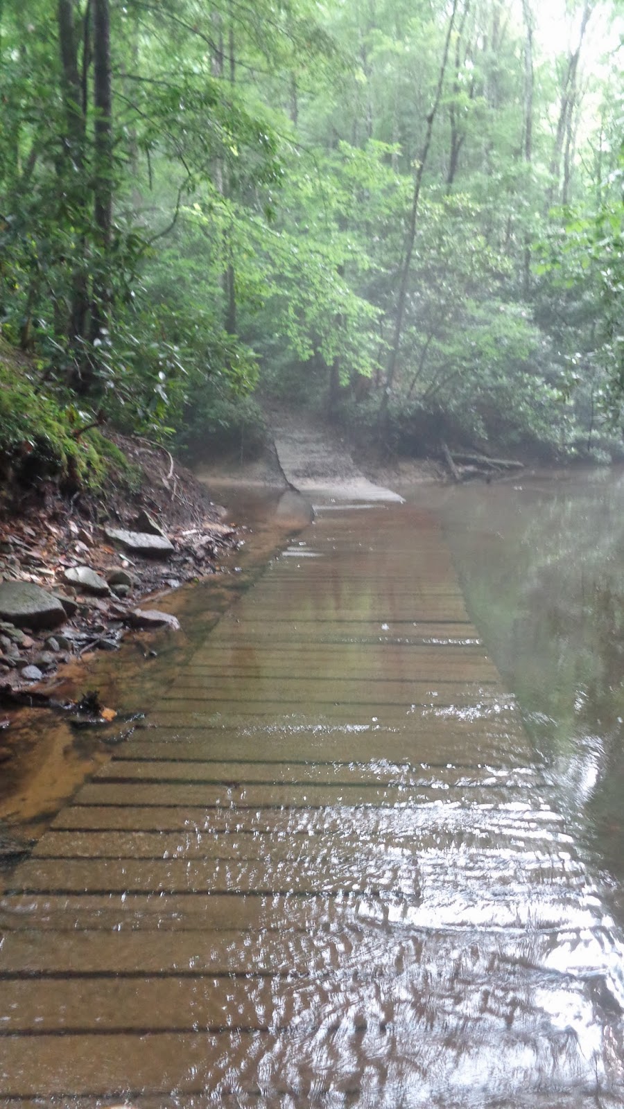
 |
| Headin' in. |
Wednesday, June 25th - Northern Terminus to Clear Creek Campground (48 miles)
Following a good night's sleep in a king bed in a Morehead hotel, it was to the terminus. Overnight rain made the early going cool and slick, but the miles were ticking off pretty easily and I was on my way to our first rendezvous at Hwy 799. I concentrated a lot on good early day nutrition knowing that a 48 mile day was going to be a little demanding. Gu gels, then Chomps, consistent mix of water and Gu Brew electrolyte drink would be the recipe for the entire trip. At 799 I found Emmy napping in her car and she took my bottles to refill while I ran on across I-64 and into my first fire road. Emmy caught up, handed off the bottles and we parted ways again as I entered a twelve mile piece north of Morehead. The first six of that section is really fast fire road, the last six is affectionately known as the roller coaster for it's brutal ridge-top climbs. By early afternoon I was back at Emmy's car, fueling up for the second crossing of I-64 and the trip to Cave Run's Stoney Cove. This is where I pulled the plug on my first day last year after a long wrong turn left me and John King running hours of road to get back on track. Better decisions this year had me arriving at Stoney Cove on time and strong enough for 10+ more miles to Clear Creek. I was disappointed to find that the Forest Service had closed this section to mountain bikes while leaving it open to horses. Wish I could say this was the last time I finished a segment ranting about hating horses and horse people, but it's not. Forgive me equine community - I will be attacking you periodically throughout this post. The section of trail from Stoney Cove to Clear Creek used to be a destination we would drive to from Cincinnati to go riding because of the sweet mix of double track then tight single track. Now it's miles of stagnant muck and horse crap. But, closer to Clear Creek it got better then dropped off the ridge, and I was 8+ miles above the average I needed to keep. Took a great swim in Clear Creek Lake then Emmy and I waited for Nick's arrival. We traded off the gear from her vehicle to his and she was headed back to our new home in Bardstown. I promised her I wouldn't die out on the trail denying her a wedding and future children - runs like this are not about running away from anything but more so running back to someone.
 |
| Six miles out in either direction. |
 |
| Thick. Headed to Stoney Cove |
 |
| Sweet reward. |
 |
| Arch near Clear Creek. |
 |
| Nick's shot. |
 |
| Half Moon Arch - I think. |
Friday, June 27th - Red River Gorge to Turkey Foot (43 miles, 126 in)
My third day last year was when things started to fall apart - everything I ate or drank was quickly vomited back up and I crumbled, missing a huge section of trail, arriving at Turkey Foot in a truck - not on foot. I knew the next 48 hours would be pivotal, and was determined to make it work. I had noticed a distinct redness around my left big toenail that was "greening up" quite nicely. Emmy and I had discussed the potential of having a script ordered up by Dr. Durall (Tony - my future father-in-law). This was no time to act like something wasn't wrong. The combination of a recently damaged toenail and stagnant water crossings had started brewing up another infection. The night prior, I couldn't deny that my pulse was evident in my toe and only there. So, as Nick and I headed toward Natural Bridge, I put in the call. By the day's end, there was an antibiotic waiting for me in London. If I was thinking, I would've started the trip with a bottle of that stuff in my bag, but Tony had saved the day and my ever-worsening toe would soon be seeing some relief. Nick and I started our Friday with a nice stroll to the top of Natural Bridge, took lots of photos, then parted ways. To keep with the plan, I needed to reach Turkey Foot Campground, and making reasonably good time for the remainder of the day would be key. Once south of the Natural Bridge, the trail gives way to more adjoining private lands, hundreds upon hundreds of nearby oil wells, and eventually reconnects with pavement at Standing Rock. For the second year in a row, I topped off my fluids at their church and motored on toward Greeley and Little Sinking Creek. Following a nice creek-to-ridge climb up out of Sinking Creek, the quadtrack trail turned back into road and I was soon refueling at the back of the truck where Hwy 52 and 399 split. This is where the trail is now detoured on to 399 all the way to Heidelberg, and it is where my wheels came off a year ago. We made a plan to deal with the midday sun - Nick would drive between a mile or two up the road, and pull over to hand up some ice water out of the bottom of the cooler which I would carry and douse myself with until our next meeting, switch bottles, repeat. I washed down some electrolyte pills with some chicken broth and was on my way to Heidelberg. After our third or fourth meeting I knew the long descent to the Kentucky River was close and I told Nick to head for the blue bridge. I made it to the Heidelberg Park feeling good and enjoyed a long lunch in the shade. From there it was south toward Cressmont along Sturgeon Creek and quite a bit more road/gravel road. This is where I missed my one and only segment of trail. I knew the Trace turned right off of the road, I tried to count the forks in the road and to use the maps to make sure I wouldn't miss what I heard was a hard to find section. I walked way, way up what I think was Hale Ridge Road - not it. Watched for every turn off, saw nothing, dropped south, still nothing, and suddenly hit a road. Looked at the map and my landmarks and soon figured out that I was standing on 587 right in front of Stonecoal Cemetery. I paced back and forth for a few minutes and decided not to back track looking for the trail and took 587 up and over Farmers Ridge. This is the one and only segment of this entire trail that I can say I have never seen. It's not but a couple of miles, but damn it broke my heart not to get it. However, after reaching Arvel feeling pretty spent, I still had nine miles of unknown to get to Turkey Foot. I think I made the right call - and ran considerably further than what I got credit for! Left Arvel at 6 p.m. and the next three hours was a pretty slow moving mix of briers and blow downs. It was beautiful trail, was never a complete beating, and did get better as it got closer to Turkey Foot. But, it could certainly use some maintenance (spoke with Steve Barber and they are actually hitting that segment very soon to prepare it for a hiker challenge). Before dark, I was greeted by another already-set-up-campsite and dipping my legs in War Fork Creek. Another big day down - pivotal day went the right way.
 |
| Natural Bridge |

 |
| Leaving Arvel heading to Turkey Foot. |
Saturday, June 28th - Turkey Foot to the 49er at I-75 (43 miles, 169 in)
 |
| Almost to the 49er text to Emmy. |
Sunday, June 29th - I-75 to Mouth of Laurel Boat Ramp/Cumberland River (33 miles, 202 in)
Things look a lot different leaving the 49er than they did 15 years ago - well, the biscuits and gravy seemed the same, but... last year I didn't take one step south of this point. Steve had talked of this area called Cromer Ridge and what he called "steeplechase". This area outside of Livingston used to be a 4x4 mecca with trails splintering off in every imaginable directions, sandstone rock gouged out by transmissions, and few and far between blazes. Now what Steve was talking about made sense. It is a Restoration Area and the "steeplechase" was the countless trees that the Forest Service had intentionally dropped across the trail to repel the off-road motorheads. It has worked. While it's not the fastest moving stuff due to a lot of overgrowth (sorry to disappoint Steve and his vision of me flying over the hurdles), it isn't too long before you're off the ridge and entering what I affectionately call Fern Gully. During this section through Hawk Creek and in the approach to Hwy 80, the trail gets really, really good. The kind of stuff I live for - increasingly cliffy, tight, technical and runnable. I got to my first refuel of the day at Hwy 80 absolutely grinning. That segment was a nice little taste, but the approach from the North into the Cane Creek WMA is pretty big green space. Nick and I decided to try for a hookup at The Narrows Road (FR 119) and it was in the interim that I got the most lost in all eight of my days on the Trace. Things were going swimmingly for a while but went wrong somewhere between Pond Ridge and Van Hook Branch. The weather was picking up, and I was covering a heck a lot of miles just not in the right direction. Eventually I topped out a long climb (after passing a number of No Trespassing signs and seeing no STA signs) and ran into a very nice man driving down his driveway as I was admiring his garden. At first he thought I was heading North, and kinda chuckled when he figured out that I was going south saying "people don't usually get lost going south." His directions, though, were sound - "go all the way back down, you'll cross a branch, you'll cross another branch, and when you cross your third branch, start looking straight ahead and you'll see your diamonds and turtles." It sounded way too easy as I felt like I hadn't seen a turtle blaze in hours. I went back in, it started storming, and I quickly found my mistake. A huge deadfall laid over the trail and guided all traffic through a sweeping turn directly onto the wrong the trail. If I had to do it ten times - I'd get it wrong ten times. Once I was sure I was on the right trail and going south (which took a while longer than I should admit), it was pouring. The kind of rain that I was scared might cause flash flood conditions. The water turned the trail into a river flowing brown over my feet as I climbed what felt like 1000 vertical feet. Got turned around again on some fire roads very close to 119 and eventually found Nick waiting at 119. I had just put in a call to tell him not to worry as I was running way behind, and it was a good thing as he was just getting ready to leave figuring he'd just missed me. I needed the fluids and a minute to dry out. From there it was down into Cane Creek and Pounder Branch and more torrential storms. It was a cool way to experience this little piece of Fern Gully as there's lots of water down there anyway. The couple of stream crossings without bridges were getting pushy with whitewater but it was a fun and safe passage throughout. Saw two groups of hikers huddled under rocky overhangs as I just slogged by in the pouring rain, loving every minute of it. By late afternoon I was rolling up on the trailhead at 192 and the Laurel Lake area. Chad was there, and he and Nick had already switched over almost all of the gear. This was the moment that I pulled out my iPhone's Ziplock and realized it was full of water. I didn't freak too much as the phone was in a Lifeproof case that had saved it from a washing machine before. Then I opened the charging port door on the case and water poured out of it. Phone dead. From this point on, I would carry a camera and would have no cell contact with my support. Nick and I said goodbye, Chad and I picked out our first hookup of the evening and discussed camping options, and I was off to knock out the super fast, easy, eight miles around Laurel Lake. It was a little surreal seeing little kids on the trail, hearing motor boats, and smelling grills. But, I made it to the dam, and we decided that the circus of the Holly Bay Rec Area would be our best bet. I headed on toward the Cumberland River and Chad rolled back up the road to nail down our campsite. It had been many years since I'd seen this segment and it was insanely technical, rocky and slippery all the way to the Mouth of Laurel Boat Ramp on the Cumberland River. Even though we would have to drive back to this spot to start in the morning, I was thrilled to have made it so far over so much super-demanding terrain and to be looking out at some big water.
 |
| Made it to the Cumberland. |
We picked up our lakeside camp at Holly Bay and drove back down to my ending point at the edge of the Cumberland River. This section is long and hard, and I knew it well from many trips over the last 20 years, both on foot and by bike. We decided Chad would just leave his truck at the Falls regardless of which way he rode, and I had extra keys - that way I could re-up and leave him a note as to when I came through. I was making pretty good time despite a lot of blowdowns and some thick growth on the lesser used sections of the trail. It was also getting harder to deny that I had some significant lower leg pain going on. It was pretty bad by the end of Saturday, really making itself known by the end of Sunday, and now was feeling a little like someone was hitting me with a hammer just above my left foot and moving up my shin. It had started to swell noticeably on Sunday and I just hoped it was a little strain that would soon let up. After rocking through, Fishing, Bark Camp, and Dog Slaughter creeks I was favoring the left leg way too much. I made a quick stop at the Falls for the obligatory photo and found the truck. Chad was somewhere out on his mountain bike, and I waited out a hard shower in the cab eating whatever I could get my hands on. Harder compression sounded like it would feel good on the leg so I found some duct tape and tightly wrapped from just about my shoe to about halfway up my shin. The next section on the other side of the river was a new one to me and it is phenomenal. It's part of the Cumberland Falls State Park and has some intersecting trails just past which I ran into Chad coming the other way. He headed back for the truck having been stoked by his first day of riding, and I continued south with the river on my left. The trace rolls around Blue Bend, then goes by some long rapids, then McKee bend. As it reaches Thunderstruck Shoals, and shortly after passing a few campsites that look more like permanent residences, the trail turns hard west and climbs out to Hwy 700. Chad and I hooked up on 700 and I topped off readying for another unknown section over to Hwy 27 near Whitley City. This piece turned out to be gorgeous stuff and even though it was intertwined with some horsey segments it also had a lot of foot traffic/bike only sections that were sweet. I ran into Chad again riding back toward me and we topped out the trail to reach the trailhead near 27. I grabbed a bag of soup and filled up my bottles. It was 8 p.m. when I passed Flat Rock Church and headed in to one last piece through Yahoo Falls and on to Alum Ford on the Big South Fork of the Cumberland River. This is why I knew Chad would be the right guy to have in the support role. Not so much that he would have my camp and dinner ready, which he did, but that he would be ok waiting through hours of darkness while I hobbled in. And dark it got, foggy too. My headlight beam was enough to follow the trail with but running was not really an option. It wasn't really an option in terms of energy levels either, so I just kept it moving best I could and was soon paralleling the river and entering the Yahoo Falls area. Pretty cool to go by the "Niagara of the South" (Cumberland Falls) and KY's tallest (130 feet I think) waterfall in the same day, although I couldn't see Yahoo Falls. The last time I saw Chad, I told him it'd be 11:00. Rolled into camp at about 10:45. The GPS Chad threw in my pack and the guidebook both said it was 40 miles. Tired, left lower leg hurt a lot, but a darn good day.


 |
| Huge overhangs |
Tuesday, July 1st - Alum Ford to Great Meadow Campground (26 miles, 268 in)
Opting for some extra compression in the form of arm warmers stretched up my legs plus calf sleeves seemed to help my swelling legs. The run down to Yamacraw Bridge was about 6 1/2 miles and I made super good time on the easily runnable trail beating Chad to the meeting place. Didn't really need anything, but the next segment was a doozy and was a little fuzzy as we encountered lots of storm damaged sections through there during our Millennium mountain bike trip. So I waited for him and we tentatively mapped out a support spot between where we were and Hemlock Grove. The trail I entered was a little overgrown as it was pretty wide open and eventually gave way to some big climbing leaving Grassy Fork and climbing up and around Devil's Knob, Grassy Knob and on to Laurel Ridge. I ran into Chad on some fire road right as I was pulling out my maps. He was following a local older fella who was super-knowledgable and friendly. He was helping one lost guy find another lost guy and within minutes had us both pointed in the right direction (although different directions) and we were headed to Great Meadow. I never really could get it going this day, just kinda stayed in a fog and plodded along. Once I finally got by Peters Mountain and dropped down by Hemlock Grove then on toward the campground. It was here I had my first experience with a bear (other than watching them from a car or a condo in some mountain resort). This time I was in a pretty tight creek with tall rock walls and thick mountain laurel - heard a big grunt and saw a large black mass bashing through the brush. Couldn't believe how fast he or she was able to get through such thick and steep terrain, and could hear every thumping footstep snarl as it climbed away - just glad it was more scared than I was. Made it to Great Meadows unscathed, saw Chad and crossed Rock Creek to join him. We opted to drive down to the end of Rock Creek Road as it was looking different than it did 14 years ago with a new gate right at the State line. We scoped it out, crossed the creek again and found the trail. My options were to go back to Great Meadows and run back to there or just do it in the morning. I was feeling kinda whimpy so I opted to leave those few miles as the start to my Wednesday. We scored a sweet (and free) camp spot on Rock Creek and worked at getting to bed early. Spent some time icing sore spots and enjoyed eating another fantastic meal Chad concocted, this time in the daylight!


 |
| 60 ft. waterfall |

 |
| Toenail finally popped |
 |
| Power food |
Aimed to make an earlier shot of it since I was a little uncertain of how I'd feel following something of a down day and having much unknown terrain between me and Leatherwood. Still got out pretty late - that's just how I roll. First thing was to drive back to Great Meadows, crossed the creek and started right where I had left off the day before. The few miles to the State line and on to the connection with the John Muir Trail took a little longer than I hoped but I was getting pretty amped about what might lie ahead (the day prior I hated the idea of having to go so much further into Tennessee). The trail used to turn West with the John Muir and end in Pickett State Park. Now it turns the other way, still running along with the John Muir, and heads up to Divide Road. Met Chad coming toward me just down from Divide Road and we were both loving the trail we had seen so far in TN. He continued along the same way I was headed and we both just geeked out on how pristine this section was. It was unreal how fast I was going and how perfect the trail and the scenery was (and was headed to an overlook!). Chad finally forced himself to turn around and we picked Bandy Creek as our next and final rendezvous. The trail topped out with stunning views, steep ladders, piles of scat - this was heaven! From there it was bomber descent all the way back to the Big South Fork of the Cumberland. Once down there, as Steve had warned me, it runs along with some horse junk. However the Trace and John Muir have sections cut up above the equine nightmare. It's new and rough but anything is better than the muck and destruction left by horses. For as fast as I had been going, I went pretty slow through this section, took in some nutrition and tried not to grow too infuriated with the horse people that had left the trail that they had already destroyed to venture on to higher ground to destroy more trail. I realized that much of this, and many other, trail networks would not exist without horse people. But, it cannot be denied that horses destroy everything they walk over - probably because the people sitting on them are not affected by the mud and ride when they shouldn't. It's like the argument that guns don't kill people -people kill people. Well, horses don't kill trails, but stupid people riding them do. Ok, I'm done. Back to how wonderful this place is. Actually it's phenomenal the job they've done to make it so good for everyone, and it is evident hat most of the trail users (equine included) are not stupid but responsible users. Anyway, after following the river down to the Station Camp crossing, the trail goes the other way and heads west toward Charit Creek Lodge. It's tough to make much sense of mileages in this area because the Trace kinda piggybacks many of the existing trails so I was guessing for something in the middle. Charit Creek is a very remote cluster of cabins, a lodge, a barn and I gather is for rent. It was empty when I got there and I explored quite a lot. And, they had running water at an outside sink! Topped off, I headed toward Bandy Creek. I ran into Chad sitting off the side of some fire road/horse trail intersection just up from Bandy - he had been there over an hour. We ate and topped off for one last section. Next time I'd planned on seeing Chad was the Southern Terminus. Bandy is a big camping complex accessible by road, which luckily the Trace skirts around. And, it does so on more killer singletrack. From there, turns up Northeast and climbs some more killer trail 'til it re-intersects the John Muir and begins the final couple mile drop down the river to Leatherwood. I ran into Chad hiking up and we enjoyed walking a nice clip for the last two miles. Although I had some visions of running into some sort of well marked terminus with my arms raised - it was much cooler just to roll out easy and enjoy my friend's companionship. The end is as anticlimactic as I was afraid of, as the Trace is really just another blaze hung on Leatherwood Ford signage. The low water bridge is even closed forcing hikers to come in the last 200 meters on the road - blah. But, that's kinda how it felt once it was done - it wasn't a crazy big deal. It was fun, it was challenging, and it was rewarding, but real quickly my feeling wasn't one of elation or conquest. It was a simple and soft satisfaction. We cleaned up in the river, ate a little something, and drove away.

 |
| The turtle and John Muir |


 |
| Scat! |

 |
| Charit Creek Lodge |
 |
| Last big view. |
 |
| Last time over the BSF |


 |
| The last turtle |
 |
| I typically have pretty skinny ankles and feet. |
 |
| At the lake and on the mend. |
STA - http://www.sheltoweetrace.org/
Steve Barber cell - 606-386-3636 (Steve has been a huge help to me)
Maps - http://www.sheltoweetrace.com/
Forest Service trail guide (out of date) - http://www.fs.usda.gov/Internet/FSE_DOCUMENTS/stelprdb5427184.pdf
Scott "Taba" Ward's thru hike guide - http://www.Thru-hiker.us/sheltowee-trace
Gear:
Shoes - Brooks Cascadia 9's
Shorts - Brooks Infiniti, HVAC, and tight shorts
Shirts - various Brooks sleeveless, Salomon T, vintage custom
Socks - Swiftwick, Ininji, Smartwool, Feetures
Leg Sleeves - Salomon, then Brooks arm sleeves under them for the last two days
Headgear - Headsweats GU visor and various Buffs
Hydration - Nathan pack and handheld, Amphipod handheld
Nutrition - GU Tri-berry gels, Chomps, Brew 2x sodium electrolyte drink, Endurolyte capsules (washed down with chicken broth everyday)